Neighbourhood Design Approach
The Site
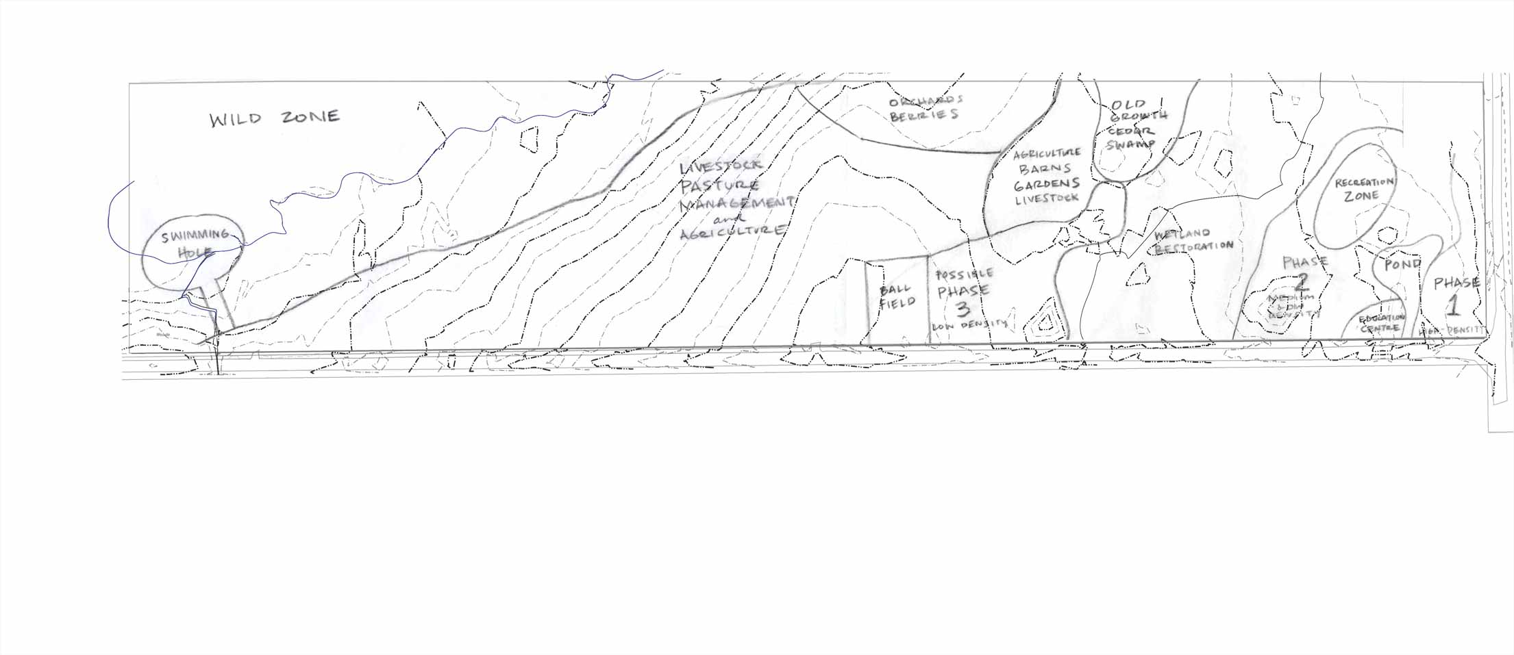
The property consists of 20 acres of hayfield and 29 acres of woods, alder brush, regenerating old pasture and wetlands. The hayfield will be devoted for agricultural production and the drier areas of woods and old pasture will be for residential and mixed commercial development.
Sustainable Community Design
During the fall and winter of 2007, the South Knowlesville Community Land Trust site underwent preliminary site analysis and development of a constraint map. In short, walking the land, getting to know its community of plants, trees, animals, soil and water is an important consideration in situating the residential development and developing a land use plan.
The draft land use plan is now under review. The goal is to have a landscape level plan that integrates the clustered residential development with ecological restoration, organic agriculture, recreation and preservation of wild areas.
Living Neighbourhoods & Pattern Language
“If one thing, more than any other, distinguishes a real neighborhood from the corporate machine-architecture of the 20th-century developer, it is the fact that real people have -- together -- conceived it, planned it, and built it. It is this human reality which makes it worth living in, pleasant to be there, and valuable.” - Cristopher Alexander
Alexander advocates reversing the usual process of building houses first and filling them with people later. A living neighbourhood can only be developed when the community of people and the physical buildings develop gradually and together.
This is the underlying principal that the South Knowlesville Neighbourhood project aims to embody. Historically villages have come about when people are interested in living in the same area.
The vision of the neighbourhood needs to attract others to the area, but also needs to have breathing room for people to add their own vision to the mix. The land use plan does not outline specific locations of buildings, rather designates density ideals.
Download the Draft Land Use Plan
|